Naovarat Surveying Co., Ltd.
Naovarat Surveying Co., Ltd.
Topographic Surveys consists of a series of tasks carried out with the aim of determining the composition of those parts of the earth’s surface which emerge from the water. It includes the coastal relief and the location of permanent natural or artificial objects and features.
Such information is partly obtained by determining the position of points on the ground, which allows
their shape as well as details of the features to be depicted, enabling their location and description to be charted. Other sources of data include remote sensing processes from aerial photogrammetric
information, other airborne sensors or satellite imagery products. In these cases it is necessary to create
ground control points in order to adjust the information to the reference frame in use.
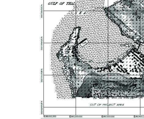
Topographic map is a type of map characterized by large-scale detail and quantitative representation of relief, usually using contour lines, but historically using a variety of methods. Traditional definitions require a topographic map to show both natural and man-made features. A topographic map is typically published as a map series, made up of two or more map sheets that combine to form the whole map. A contour line is a line connecting places of equal elevation.
Design by www.meeidea.com
© 2018 Naovarat Surveying All rights reserved.


